Stunning satellite images released by NASA in January 2026 have placed Hartbeespoort Dam under the international spotlight, revealing enormous swirling green formations across the water. While the images are visually spectacular, they tell a troubling story about pollution, invasive aquatic plants and the deteriorating health of one of South Africa’s best-known dams.
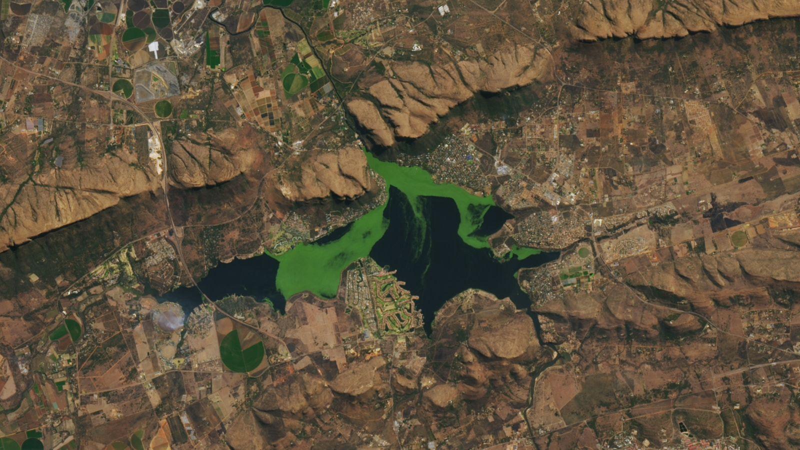
NASA satellite imagery reveals vivid green formations spreading across Hartbeespoort Dam. Image: NASA Earth Observatory / Landsat.
On 7 January 2026, the United States National Aeronautics and Space Administration (NASA) published a remarkable series of satellite images showing bright green masses forming, drifting and disappearing across Hartbeespoort Dam.
The images, featured by NASA’s Earth Observatory under the title Plants and Algae Swirl Across a South African Reservoir, attracted attention to a water pollution problem that Hartbeespoort residents have been battling for decades.
From space, the dam resembles a giant natural canvas, with vivid green patterns swirling through its dark blue waters. But the spectacular formations are not simply an unusual natural phenomenon.
They are evidence of a complex environmental problem involving excessive nutrients, algal blooms and invasive aquatic vegetation.
What exactly did NASA capture?
NASA’s animation documents the movement of green formations across Hartbeespoort Dam between June 2022 and July 2023.
Importantly, although NASA published its findings in January 2026, the satellite footage itself was captured several years earlier.
The animation combines observations from NASA and the United States Geological Survey’s Landsat 8 and Landsat 9 satellites with imagery from the European Space Agency’s Sentinel-2 satellites.
Together, these observations reveal how aquatic vegetation and algae expand across the reservoir, shift position and eventually decline, only for new growth to appear.
The green formations include invasive floating plants such as water hyacinth and salvinia, as well as varying amounts of algae.
NASA’s findings demonstrate how the dam’s appearance can change dramatically over relatively short periods.
A beautiful sight hiding a serious problem
Although the green formations may appear beautiful from space, scientists warn that excessive algal growth can threaten aquatic ecosystems.
The underlying problem is known as eutrophication, a process in which excessive nutrients, particularly phosphorus and nitrogen, stimulate rapid growth of algae and aquatic plants.
Hartbeespoort Dam receives nutrient-rich water through the Crocodile River system, which drains heavily developed areas upstream.
Wastewater, agricultural runoff and other nutrient sources contribute to the conditions that allow aquatic plants and algae to flourish.
NASA scientist Bridget Seegers compared the process to fertilising a garden: adding more nutrients encourages more growth.
However, in a dam, this excessive growth can have devastating consequences.
When large quantities of algae and aquatic plants die, bacteria breaking down the organic material consume dissolved oxygen in the water.
This can create oxygen-depleted conditions, sometimes described as aquatic dead zones, where fish and other organisms struggle to survive.
In April 2023, South Africa’s Department of Water and Sanitation linked a major fish kill at Hartbeespoort Dam to oxygen depletion associated with excessive algal growth.
The green menace: algae, hyacinth and salvinia
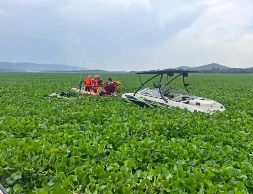
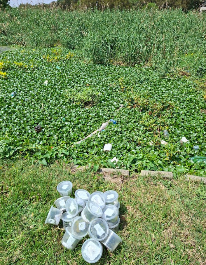
Hartbeespoort Dam has long been associated with invasive water hyacinth, which can form enormous floating carpets across the reservoir.
More recently, the invasive aquatic fern Salvinia minima has added another dimension to the problem.
NASA specifically acknowledged the presence of salvinia in an update to its article on 13 January 2026.
Although hyacinth and salvinia do not produce the toxins associated with some harmful algal blooms, their rapid growth can block sunlight, interfere with recreational activities and contribute to oxygen depletion when the plants die and decompose.
Certain cyanobacteria, commonly called blue-green algae, can produce toxins harmful to people and animals. However, not every green patch visible from space is toxic, and laboratory water testing is required to determine whether a particular bloom poses a toxin risk.
This distinction is important because the green formations captured in NASA’s images cannot all be identified as toxic algae from their colour alone.
Forty years of satellite evidence
Perhaps one of the most disturbing aspects of NASA’s report is that Hartbeespoort Dam’s water quality problems are far from new.
The agency highlighted research published in 2022 that examined approximately 40 years of satellite observations, covering the period from 1980 to 2020.
Researchers found that two major factors influenced algal growth in the dam: phosphorus concentrations and water temperature.
Blooms generally increased during the warmer summer months and declined during winter.
The study also identified areas where algal productivity was particularly high, including sections near the Crocodile River inflow and the western parts of the reservoir.
According to the research, nutrient inputs and restricted water circulation contributed to these patterns.
The study further identified periods of particularly intense algal growth between 1982 and 1986.
A bioremediation programme introduced during the late 1980s helped reduce algal growth, but blooms increased again after programme funding ended in the late 1990s.
These findings suggest that Hartbeespoort’s environmental difficulties are deeply rooted in the broader catchment system rather than being caused by a single recent event.
Can satellites help save Hartbeespoort Dam?
NASA’s observations demonstrate the growing importance of satellite technology in monitoring water quality.
By analysing how different wavelengths of light are reflected from the water, scientists can estimate concentrations of chlorophyll-a, a pigment associated with algae.
These measurements help researchers track changes in algal abundance, identify recurring problem areas and understand how environmental conditions influence blooms.
Satellite monitoring also provides a much broader view than observations made from individual locations along the shoreline.
NASA’s PACE satellite mission, launched in 2024, offers additional capabilities for studying aquatic ecosystems, although its spatial resolution makes it more suitable for larger water bodies and coastal environments.
Closer to home, researchers at Rhodes University’s Centre for Biological Control are also using satellite imagery to monitor invasive aquatic vegetation at Hartbeespoort and other South African dams.
A problem visible from space, but requiring solutions on Earth
The challenge facing Hartbeespoort Dam extends beyond its appearance.
The reservoir supports tourism, boating, fishing, irrigation and numerous businesses that depend on a healthy aquatic environment.
Persistent invasive vegetation and algal blooms threaten these activities while placing additional pressure on the dam’s ecosystem.
Biological control programmes have shown encouraging results against water hyacinth. During 2026, researchers reported that large populations of hyacinth-feeding plant hoppers were damaging the invasive plants and reducing their ability to thrive.
However, controlling floating vegetation does not remove the excess nutrients already entering the reservoir.
Long-term improvements will require sustained action to reduce pollution throughout the Crocodile River catchment, improve wastewater treatment, manage nutrient runoff and maintain effective environmental monitoring.
Hartbeespoort’s warning to the world
For residents who have watched the dam struggle with hyacinth infestations, algae and declining water quality for years, NASA’s satellite images offer little that is unfamiliar.
What makes the images extraordinary is their perspective.
From hundreds of kilometres above Earth, the environmental challenges facing this iconic North West reservoir are clearly visible.
The bright green formations may create spectacular satellite photographs, but they also illustrate the consequences of decades of nutrient pollution.
NASA’s January 2026 publication has effectively turned Hartbeespoort Dam into an international example of how satellite technology can reveal the scale and persistence of water quality problems.
For the people living and working around the dam, however, the challenge remains much closer to home.
The real achievement will not be making Hartbeespoort Dam look less green from space, but restoring the health of the water beneath those green formations.
ALSO READ:
Plants and Algae Swirl Across a South African Reservoir